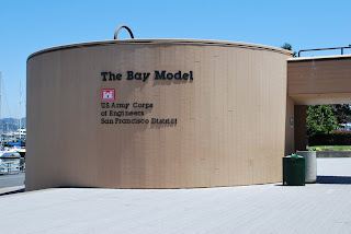

34. the bay model

The San Fran. bay is the largest estuary of all the North American west coast and just over the red bridge, in Sausalito, the army core of engineers have created a working scale hydraulic-model of the bay, the rivers flowing in, and the big salty "peaceful sea." The model is of concrete and paint, plaster and steel, pipes and water. One can walk about the 2-acre bay-model-warehouse past the San Pablo Bay, the South Bay, the Pacific Ocean, the Suisun Bay, Honker Bay, and a portion of the Sacremento-Sanjoaquin River delta.

Continual battles over water rights, salinity and waste, between industry, farmers, fishes and flocks create quite a fragile and malleable environment in both the Bay and Central Valley. The hydraulic model was constructed in the 50s with hopes to arrive at the most bountiful decisions for all the Bay. The model simulates currents and tides. It has tested dredging channels, salt water intrusion into the delta, and has simulated the dispersal of treated waste-water.

The Central Valley of California is 400 miles long, much like "the size of Tennessee," as they say. Most of the area at one time was seasonal wetland, with flat open spaces, woodlands, and a thriving natural environment.
When the gold rush brought in the modern humans, when the gold was exhausted, the migrants turned to farming. These farmers built the first levees of the valley, diverting water to their pleasure and sowing their crops on the freshly manifested highgrounds.
People began calling these plots "islands of agriculture." Today the valley is loaded with reservoirs, canals, pumping plants, and aquaducts. Before the humans, even the great bear that is the CA state symbol, the grizzly, walked these lands.

In most instances, river deltas, the fingery sediment landforms at the mouths of rivers, form where the river meets the sea. In the water sheds of California, the delta forms inland where the major rivers of the Central Valley merge near Sacramento, CA. The Sacramento River flows from the north, and the San Joaquin flows from the south.


